
A Project Manager's Guide to Karst & Cave Surveys in Central Texas
If you are acquiring property or planning construction in Central Texas, your site may sit on karst: caves, sinkholes, and underground drainage that can harbor federally protected species. This guide walks you through karst-related ESA compliance so you can make informed decisions and keep your project on schedule. Zara Environmental holds a USFWS Section 10(a)(1)(A) permit and performs these surveys in-house.
Download the PDF GuideWhen a Karst Feature Survey Is Required
A Karst Feature Survey is a protocol-driven survey conducted under US Fish and Wildlife Service (USFWS) guidance. It applies to projects in Bell, Bexar, Comal, Medina, Travis, and Williamson Counties when any portion of the site falls within Karst Zone 1, 2, 3a, or 3b, or within a 500-foot buffer of those zones. The buffer exists because the zone maps carry a mapping margin of error of more than 400 feet. Projects located entirely within Zone 4a or 4b and outside the 500-foot buffer do not require a Karst Feature Survey.
The survey identifies karst features (caves, sinkholes, solution cavities, and similar openings) and assesses each one to determine whether it provides suitable habitat for listed species. If suitable habitat is confirmed, the next step is a Presence/Absence Survey to determine whether listed species actually occupy the feature.
A note on salamanders: Several Central Texas Eurycea salamanders are federally listed. Flowing or standing water in a karst feature may trigger a Salamander Presence/Absence Survey as well.
Common Regulatory Agencies Involved
- US Fish and Wildlife Service (USFWS)
- Texas Parks and Wildlife Department (TPWD)
- US Army Corps of Engineers (USACE)
- Texas Commission on Environmental Quality (TCEQ)
Timing & Seasonality
Karst Feature Surveys and karst invertebrate Presence/Absence Surveys can be conducted year-round, but weather matters. Features are not entered during heavy rain or flooding, and temperature extremes or low humidity can make a survey invalid. Salamander surveys are tied to water: at least 8 of the 15 required surveys must occur between February 1 and September 1 of the same year, and a dry site cannot be surveyed to infer absence.
When to engage a karst consultant: ideally once your project footprint is confirmed, so the survey covers exactly what will be affected. Engaging earlier, during feasibility and routing, lets you identify features to avoid before the layout is locked in.
Estimated Project Timeline and Cost
Estimated Timeline
(with reporting)
Feature Survey
Estimated Cost
(survey through Presence/Absence)
iNote: Timelines and costs vary widely depending on project specifics. Zara provides detailed estimates with every proposal.
What to Expect from a Karst Feature Survey
Karst work is sequential. Each phase determines whether the next is needed, so many projects finish after the Karst Feature Survey and never move on to Presence/Absence Surveys. Habitat assessments, excavations, and Presence/Absence Surveys must be performed by, or under the direct supervision of, USFWS Section 10(a)(1)(A) permit holders. Zara holds this permit and performs all of this work in-house.
How long are results good for? USFWS recommends repeating a Karst Feature Survey if none has been conducted on the property within the last 10 years. A salamander absence finding expires three years after surveys are completed.
No two karst projects are identical, but most follow this general sequence.
Why Are There So Many Presence/Absence Surveys?
USFWS requires a high level of confidence that a species is absent before a site can advance with development or construction. Current protocols call for 14 Presence/Absence Surveys per karst feature and 15 for salamanders. A single visit can confirm presence, but establishing probable absence is harder. Repeated surveys across different conditions, including day and night visits and, ideally, both spring and fall, reduce the risk of missing a species that is present but undetected.

On-Call Construction Monitoring
A karst feature can be as small as a fist-sized hole and may go undetected until grading peels back the surface. For this reason, many project managers keep a Section 10(a)(1)(A) permitted construction monitor, like Zara's, on call during ground-disturbing work. If a void is encountered, work within a set distance (typically 50 feet) stops, and the monitor responds promptly to assess whether suitable karst invertebrate habitat is present.
If no suitable habitat is present, construction continues. If suitable habitat is present, the work stoppage stays in place, best management practices (BMPs) are installed, and Presence/Absence Surveys follow USFWS protocol. Voids too small to enter can instead be baited and checked for a minimum of 14 days. On-call monitoring keeps timelines on track and gives you a fast, defensible response when a feature turns up unexpectedly.
Key Considerations
What factors impact the scope, timing, and cost of Karst Feature Surveys?
- Size of the assessment area: Cost is anchored to acreage. Larger sites take longer to walk and may require bigger field teams.
- Location: The county and karst zone determine which species may be present, which requirements apply, and whether a regional habitat conservation plan (for example, in Bexar or Williamson County) offers a streamlined path.
- What is found: Finding no suitable habitat keeps cost and schedule at a minimum. Confirmed suitable habitat moves you into Presence/Absence Surveys (roughly 10 additional weeks), and that cost scales with the number of features surveyed.
- Water on site: Springs or water within a karst feature can trigger salamander surveys, which are tied to flow conditions and the February through early September window.
- Agency timelines: Anything that requires USFWS review or consultation adds time that is outside everyone's control.
Choose Zara Environmental for Karst Management Services
- Hundreds of karst habitat surveys completed for public and private clients, including TxDOT, military installations, and regional habitat conservation plans.
- USFWS Section 10(a)(1)(A) permit holders for karst invertebrates and Eurycea salamanders, backed by karst geologists who map, excavate, and evaluate features.
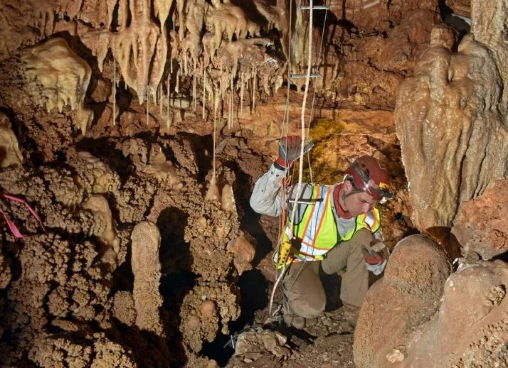
- Technical experts in Karst Feature Surveys, proficient in safely accessing and navigating cave systems, including vertical and confined-space work.
- End-to-end project support, from karst zone determination through Presence/Absence Surveys, construction monitoring, and agency coordination.
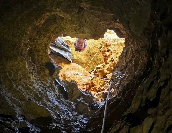
Founded by leading karst scientists, Zara Environmental has been performing complex karst management services under demanding conditions since 2003. Our team collaborates closely with regulatory agencies to advance best practices and brings industry-leading expertise to every feature we evaluate. Through a proactive approach and comprehensive capabilities, we help clients manage risk effectively and keep project schedules intact.